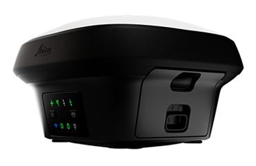
The Leica GS18 T is the fastest and most user-friendly GNSS RTK rover in the world. now you can measure point faster and easier because you don’t have to hold the pole vertically.
This latest innovation combines GNSS with inertial measurement unit (IMU) being the first true tilt compensation solution that is immune to magnetic disturbance and is calibration-free. The GS18 T works directly out of the box
You can save up to 20 percent time compared to conventional surveying practices due the fact that no time is wasted by leveling the bubble. Avoid time consuming auxiliary methods with true tilt compensated surveying. Work more efficiently and conveniently than ever before with increased speed, safety and comfort.
The GS18T GNSS RTK rover is part of the Leica Geosystems self-learning GNSS series. It seamlessly combines with Leica Captivate field software and Leica Infinity office software, continuing the powerful and immersive Leica Captivate Experience.
Features :
TILT COMPENSATION
■ Increased measurement productivity and traceability
■ Calibration-free
■ Immune to magnetic disturbances
■ Integrated quality assurance of pole tilt
■ Reduction of human error
RTKplus
■ 555 channels for more signals, faster acquisition and improved sensitivity
■ Intelligent management of multi-frequency, multi- constellation signals
■ Intelligent selection to automatically reject reflected or noisy signals
SMARTLINK
■ Achieve centimetre accurate positioning worldwide – perfect when working in remote areas around the globe
■ No RTK base station or RTK network required, correction data is continuously transmitted by satellite delivering global coverage
■ Bridging RTK outages for uninterrupted centimetre positioning
SMARTCHECK
■ Unique RTK technology provides continuous checks to guarantee correct results
■ Initialisation within seconds
■ Complete reliability
BUILT FOR THE MOST DEMANDING ENVIRONMENTS
■ IP66 / IP68 protection
■ Built for extreme temperatures of -40°C to +65°C
■ Fulfils toughest standards throughout the complete product lifetime
■ Rugged aluminium housing
ERGONOMICS
■ Integrated 4G mobile phone, UHF radio RTK devices
■ Compact housing
ONLINE SERVICES
■ HxGN SmartNet Satellite Positioning – your No.1 partner for network RTK
■ Leica Active Assist – the next level in support
■ Leica Exchange – transfer data easily, quickly and safely
The Leica GS18 T is accompanied with the revolutionary Captivate software, turning complex data into the most realistic and workable 3D models. With easy-to-use apps and familiar touch technology, all forms of measured and design data can be viewed in all dimensions. Leica Captivate spans industries and applications with little more than a simple swipe, regardless of whether you work with GNSS, total stations or both. Leica Infinity imports and combines data from your GNSS RTK rover, total station and level instruments for one final and accurate result. Processing has never been made easier when all your instruments work in tandem to produce precise and actionable information.
Multipath reduction and interference mitigation options in Captivate boost GNSS signal tracking quality under harsh environments, which improves RTK availability and accuracy. Also, an interference toolkit will enable filtering to remove in- and out-of-band distortions for even more robust GNSS signal tracking. Tracking multi-frequency signals comes as standard with all Leica Geosystems GS sensors. Combined with an excellent GNSS antenna element and a position update rate of 20 Hz, GS18 T ensures reliable measurement quality.
Source : https://leica-geosystems.com
[…] that it enables you to measure what you see. Leica GS18 I have all the functionality of the Leica GS18 T, in addition to Visual Positioning, users can for example map points with either tilted or leveled […]