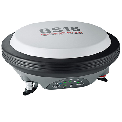
The Leica Viva GS16 is a powerful self-learning GNSS smart antenna with RTKplus and HxGN SmartNet Global. The growing number of signals from ever-increasing satellite constellations demands the GNSS receiver to be smart and reliable. RTKplus intelligently adapts to changing conditions by selecting the optimal signals to deliver the most accurate positions. The GS16 is a solid measurement companion for surveyors who need a survey-proof GNSS system that is light to carry anywhere but handles even the most challenging measurement conditions. The GS16 is a smart solution – Use it as a rover or as a trustworthy base.
Features :
RTKplus
- 555 channels for more signals, faster acquisition and improved sensitivity
- Intelligent management of multi-frequency, multi-constellation signals
- Intelligent selection to automatically reject reflected or noisy signals
SMARTCHECK
- Unique RTK technology provides continuous checks to guarantee correct results
- Initialisation within seconds
- Complete reliability
HXGN SMARTNET GLOBAL
- HxGN Smartnet Pro – Network RTK and unlimited worldwide RTK bridging and PPP service
- HxGN SmartNet+ – Network RTK and up to 10 min RTK bridging service
- HxGN SmartNet PPP – Unlimited worldwide RTK bridging and PPP service
RUGGED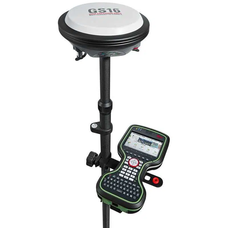
- IP68 protection
- Built for extreme temperatures of -40°C to +65°C
- Fulfils toughest standards throughout the complete
product lifetime
ERGONOMICS
- Integrated mobile phone and UHF radio RTK devices
- Compact housing
- Lightweight
ONLINE SERVICES
- Leica Active Assist – the next level in support
- Leica Exchange – transfer data easily, quickly and safely
The Leica Viva GS16 GNSS smart antenna is accompanied with the revolutionary Leica Captivate software, turning complex data into the most realistic and workable 3D models. With easy-to-use apps and familiar touch technology, all forms of measured and design data can be viewed in all dimensions. Leica Captivate spans industries and applications with little more than a simple swipe, regardless of whether you work with GNSS, total stations or both.
Leica Infinity imports and combines data from your GNSS, total station, level instruments and laser scanners for one final and accurate result. Processing has never been easier because all your instruments work in tandem to produce precise and actionable information.
Through Active Customer Care (ACC),
a global network of experienced professionals is only a click away to expertly guide you through any challenge. Eliminate delays with superior technical service, finish jobs faster and avoid costly site revisits with excellent consultancy support. Control your costs with a tailored Customer Care Package (CCP), giving you peace of mind you are covered anywhere, anytime.
Source : https://leica-geosystems.com